The drought that gripped Washington in the summer of 1966 was one for the record books. Already suffering from several straight years of below-normal rainfall, the region watched and sweated as the precipitation deficit mounted. From May through August, when usually about 16 inches of rain fall to wet our lawns and keep the Potomac flowing, the gauges measured just 7 inches.
In the Maryland and Virginia countryside, it was a tough year for farmers. Clouds of dust rose from the hard-baked soil as it was prepped for spring planting, ponds and wells began going dry, and most of the counties around Washington were declared federal disaster areas. A dairy farmer in Herndon told the Washington Post his hay crop “wouldn’t feed a goat,” and yields were down in corn, soybeans, tobacco, peanuts, apples, peaches, and tomatoes. At the farmers market in Bethesda, the supply of sweet corn was so short that the price rose to a shocking $1 for a dozen ears.
In the heart of the District, lawns were brown and public fountains were shut down to preserve water—all reminders that drought may develop slowly but has devastating effects. Lady Bird Johnson, the First Lady who had made beautification of the landscape a national cause, was saddened to hear that hundreds of trees just planted along the Baltimore-Washington Parkway were dying and that watering of the White House flower beds was being curtailed. She issued a plea for citizens to dump leftover dishwater on their trees and shrubs.
The situation became so dire in late summer that DC declared its first “water emergency” in more than a century. The city, along with some suburbs, imposed restrictions on water use, prohibiting the watering of lawns and gardens, the use of hoses to wash cars or clean streets, and the filling of swimming pools. Police patrolled the streets watching for violations in suburban Maryland, and a Goodyear blimp was used to monitor the dwindling level of the Potomac.
The river, source of much of the region’s water supply, was checked each day with growing concern. The water utility in suburban Maryland piled sandbags in the river to dam up a bigger pool to feed its intake. The Washington Aqueduct, which supplied water to DC and parts of Northern Virginia, pumped water out of the river into the Chesapeake & Ohio Canal, where it could be stored in case the river got any lower.
Maryland senator Charles Mathias, after a trip upriver, reported that there were places “where you can walk across . . . without getting your feet wet.” At Great Falls, teenagers proved the point by hopping rocks from the Maryland shore to Virginia in what looked like a little mountain brook. “What we need,” Mathias said, “is a hurricane.”
By September the Potomac was down to a level not seen since the Depression-era drought of 1930. On September 11, the Potomac’s daily flow at Chain Bridge was a record-low 374 million gallons. With demand at 291 million gallons a day, we were sucking up all but 83 million gallons of the river’s life-giving water. That left barely enough to keep the fish alive.
Then, suddenly, the crisis ended. It was not the hurricane that Mathias hoped for, but on September 14 a big storm rolled in and settled for several hours over the thirsty region. It rained 4½ inches, the biggest soaking in nearly four years, enough to bring the Potomac back to life and put several local creeks over their banks. The drought had been washed away, but it left behind a worry about what could happen when a city goes dry.
Water covers nearly three-fourths of the earth’s surface and makes up more than half of the human body. Without water, plant and animal life is impossible. Cities such as Washington that ordinarily have lots of water are the envy of arid places like Los Angeles, which must import water by aqueduct from the Sierra Nevada mountains hundreds of miles away. Water is a matter of life or death: The oases of the Sahara and the watering holes of the Old West are symbols of survival and water is so essential that it can inspire the sort of violence on display in the movie Chinatown. Even where water is plentiful, it is often not clean, healthy, and drinkable—a situation that prevails from the slums of Latin America and Africa to India’s sacred Ganges. No wonder stockbrokers are touting the idea of investing in water—they call it “the oil of the 21st century.”
Though water in Washington is as renewable as the rain, delivering it to customers is anything but simple. Three nonprofit, self-financed public utilities—the Washington Aqueduct, Washington Suburban Sanitary Commission, and Fairfax Water—treat and distribute most of the region’s water, though several other public agencies, including the DC Water and Sewer Authority, buy water wholesale from the big three and pass it on to customers through their own pipes. It is a complex feat of engineering involving several Potomac intakes, reservoirs, and treatment plants as well as dozens of water-storage tanks, hundreds of fire hydrants, many pumping stations, and thousands of miles of mains to reach more than 4 million consumers. Together the big three maintain more than 170,000 valves, including some very expensive ones that are six feet in diameter. Parts of the system in DC date back nearly 150 years.
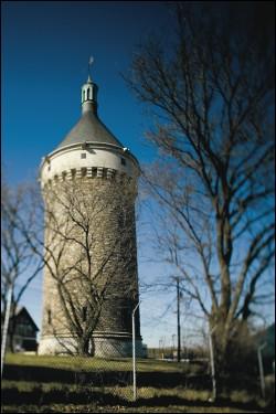
Except for water towers on the horizon, much of this infrastructure is hidden and taken for granted. “Ninety percent of our assets are buried,” says one utility official, “out of sight, out of mind.”
While we’re accustomed to electrical outages, late flights, traffic jams, and delayed subway trains, hardly ever do we turn on a faucet and get no water. Such reliability has developed over many decades, starting in DC before the Civil War then spreading into its suburbs—a story that is a metaphor for Washington’s growth.
But many consumers have questions about system vulnerabilities: With Washington adding thousands of new residents each year, could another drought leave us with a catastrophic shortage? Is the water always safe to drink, or are we likely to see repetitions of the 2004 lead-contamination scare in DC? Is it possible that terrorists could kill thousands of people by dumping a toxic substance into our water?
DC Begins Tapping the Potomac
Patty Gamby, an engineer with the Washington Aqueduct, is dressed in hip-high rubber boots and a white hardhat, her flashlight providing the only light in the big circular tunnel. Her boots make a splashing sound as we move through six inches of water, and we can hear from above the thump-thump-thump of car traffic on MacArthur Boulevard as it narrows to one lane crossing Cabin John Bridge. Flipping on her radio, she tells an above-ground safety crew of our location: “We’re entering the bridge now.”
She is on an inspection tour of “the Conduit,” which carries raw Potomac River water from an intake just above Great Falls down to the Dalecarlia Reservoir on the Maryland/DC line, where it will be sent on for treatment. The conduit is drained and inspected inch by inch every two years. Nine feet in diameter and nearly ten miles long, lined with bricks and concrete, it carries millions of gallons of water each day.
Gamby has been doing this for years, so she is familiar with the stuff that slips through the intake’s screens and comes roaring down the conduit with the water. There are small rocks along with clumps of leaves and a couple of inches of river sediment. In pools of shallow water are a few small fish and eels, which sometimes are as big as a man’s arm. “Once,” she says, “I found a child’s doll.”
There are a few grotesque tree roots that have grown between the bricks and hang down in the darkness—their locations noted so that crews above ground can cut down the offending trees. Gamby also records all cracks that might be dangerous and puts them on a repair list.
But they are rare. That is all the more surprising because the conduit dates to the Civil War era—a project constructed by slaves and immigrants just as America was entering the industrial age. “No matter how many times I walk through here,” Gamby says, “I am always amazed that it’s still in such good shape.”
For several decades after Washington’s founding in 1790, its residents got water for themselves and their horses from cisterns, wells, and springs—some private and some owned by the new federal government. Spring water was first piped to the White House in 1816 and to the Capitol a couple of decades later—at first through bored-out logs, later through cast-iron pipes.
The shortcomings of this arrangement were evident by the 1850s. The city’s population, about 3,000 in 1800, was up to 58,000. Wells sometimes became polluted by sewage, and waterborne diseases, especially typhoid fever, were a threat. Water for firefighting was inadequate, a matter emphasized on Christmas Eve 1851 when a spark from a stove in the Capitol destroyed the room housing the Library of Congress.
All of this prompted Congress to appropriate money to plan construction of a new water-supply system, a task that was assigned to the US Army Corps of Engineers. That made sense, partly because Washington was a federal district but also because West Point was then the country’s only source of professional engineers. The officer put in charge was Lieutenant Montgomery C. Meigs, an ambitious young man who would become one of the most important builders in the city’s history. Besides the water-supply system, Meigs was the key figure in finishing the Capitol dome, in creating Arlington National Cemetery, and in designing and constructing the Old Pension Building (now the National Building Museum).
Within three months Meigs produced a 55-page plan that even now is the basis of DC’s water-supply system. He studied the systems in America’s biggest cities—New York, Boston, and Philadelphia—as well as those of Paris and London. Their big mistake, he concluded, was thinking small and ending up with a system that could not keep pace with a growing population. He envisioned, as appropriate for the capital of a great republic, a city adorned with towering fountains in the manner of ancient Rome.
Though some had proposed using Rock Creek as a source of water, Meigs recognized that Washington’s real good fortune was the Potomac, which delivered huge amounts of water right into the heart of the city. The river, which had been central to the decision to locate the capital here, stretched nearly 400 miles to the north and west, draining nearly 15,000 square miles in four states.
Meigs the engineer also realized the significance of Washington’s location on the “fall line,” the geological formation downriver from Great Falls where the elevated Piedmont Plateau gives way to the low-lying Coastal Plain. The difference in elevation there meant that water could be moved into the city entirely by gravity, a crucial advantage in an age when steam pumps were primitive and long before the invention of electrical pumps. By building a water-pooling dam and an intake just above Great Falls, Meigs could use the falling elevation to propel water south through his proposed conduit to Dalecarlia Reservoir and beyond. (The required slope is only 9½ inches per mile.) Just as crucial was the fact that the water above Great Falls was fresh instead of the brackish tidal water farther down the river.
This project began in 1853 and became known as the Washington Aqueduct. Its history is recounted in an excellent book by Harry Ways, who is retired as the institution’s chief engineer. During construction, the project had its own wharf in Georgetown to receive bricks, cement, pipes, and valves; dozens of horses and mules; canal boats to move sandstone from the Seneca Quarry; and more than 2,000 workers. There were many difficulties to overcome: irregular appropriations from Congress; criticism that the people of Washington rather than the federal government should be paying; illness among workers as well as excessive drinking; land speculation along the route; and fear of a Confederate raid during the Civil War.
One of the project’s most unusual features was Cabin John Bridge, which carried the conduit at a height of 100 feet over Cabin John Creek. Today, with a single lane and stoplights to control one-way traffic, the bridge may seem like a nuisance to commuters. But when it was completed in 1863, it was, at 451 feet, the longest single-arch masonry bridge in the world. The name of Montgomery Meigs is carved on the bridge’s side, as is that of Jefferson Davis, the secretary of War when the project began; Davis’s name was removed when he became president of the Confederacy but restored in 1908 by President Theodore Roosevelt.
Meigs also created two small reservoirs, both landmarks along present-day MacArthur Boulevard, to store the water delivered via the conduit and to allow river sediment to settle out before the water was distributed. Farthest north, at the DC line, was the 50-acre Receiving Reservoir (now called Dalecarlia Reservoir), created by damming Little Falls Branch. Two miles south was the 36-acre Distributing Reservoir (now called Georgetown Reservoir), a rectangular pool that features a small castle, added in 1902, that resembles the insignia of the Army Corps of Engineers.
The water moved from these reservoirs into Georgetown, where some of it was lifted by a pump to a brick-domed storage reservoir on high ground now occupied by the Georgetown branch of the DC Public Library. Big cast-iron pipes carried water across Rock Creek at Pennsylvania Avenue—pipes that were arched to do double duty supporting a traffic bridge and that are still in use today, though the bridge has long since been reinforced. From there the water traveled into the center of the city and to the Capitol and the Navy Yard, nearly 19 miles from its origin at Great Falls—all by gravity. To show off this feat, Meigs created a public fountain at the foot of Capitol Hill, where the pressure was enough to shoot water 100 feet high.
Complaints soon arose, given that the system had limited ability to get rid of suspended sediment and no chemical treatment. One citizen, who had expected water that would be “as bright and clean as liquid diamond,” found that it often was turbid—“the muddiest, dirtiest water that ever went down the throats of human beings.” Pressure was too low, especially when the Navy Yard was drawing lots of water or people were taking their weekly baths. Without disinfecting treatment, typhoid fever remained a problem.
The situation was rectified by a series of improvements in the early 20th century. A deep tunnel was blasted out of bedrock from the Georgetown Reservoir across town to deliver water to a new 38-acre McMillan Reservoir just east of Howard University. There the water was put through a new filtering system using sand; additional protection came with the introduction of chlorine disinfection in the early 1920s. Many of the old sand filters, which were abandoned in 1985, still stand just south of Washington Hospital Center.
Other elements of the current system have been added over the years—a second conduit from Great Falls to Dalecarlia Reservoir (1927), a new treatment plant on MacArthur Boulevard (1928), a new dam and intake at Little Falls (1950s), and a replacement treatment plant at McMillan Reservoir (1985). Washington Aqueduct also has some of the largest water-storage facilities in the region, built on high elevations to create the pressure to serve large sections of the city. One of the biggest, at Fort Reno in DC’s Tenleytown, holds 20 million gallons underground.
DC’s water system is complicated by the fact that while the Washington Aqueduct continues to produce the city’s water under the auspices of the Army Corps of Engineers, many of the distribution mains, pumping stations, and additional storage tanks are under control of the DC Water and Sewer Authority. WASA, which buys water wholesale from the aqueduct, is a semiautonomous agency created in 1996 so that the water system no longer would be a department within the DC government. The change was prompted by the diversion of millions of dollars from water bills to other city departments, leaving the water utility a dysfunctional operation with a big backlog in maintenance.
Water to Keep the Suburbs Green
Long after DC got its first taste of Potomac River water, the adjacent jurisdictions in Maryland and Virginia remained sparsely populated and dependent on wells. But Arlington, Alexandria, Fairfax County, Montgomery, and Prince George’s were poised for development, and a ready supply of clean water was essential. Beginning as early as the 1890s in a few places, but with sprawling force after World War II, these jurisdictions were transformed into modern suburbs. Between 1920 and 1970, those five jurisdictions grew from 120,000 residents to almost 2 million, which translated into lots of baths and garden hoses.
The suburban water-supply system began developing first on the Maryland side of the river. The key event, in 1918, was creation of the Washington Suburban Sanitary Commission, which was promoted by Democratic political boss T. Howard Duckett of Prince George’s County. The commission was set up to provide both water and sewer service to the populated parts of both Prince George’s and Montgomery—a situation that has prevailed ever since.
The WSSC began to buy existing water systems, some run by municipalities and some by developers or other private owners. These purchases merged Chevy Chase, Edgemoor, Glen Echo, Kensington, Takoma Park, and Mount Rainier into a single system, and new mains were built to serve growing communities including Silver Spring and College Park. Only Rockville, Montgomery’s county seat, remained apart, even today operating its own plant to process water from the Potomac. The WSSC’s first treatment plant, a sand-filter operation in Hyattsville, was built in 1920 and drew water from a branch of theAnacostia River.
To meet the demand for water, which grew with every new subdivision, WSSC first looked east to the Patuxent River, which forms the border between Montgomery and Howard counties and farther south between Prince George’s and Anne Arundel. It built the Brighton Dam on the Patuxent in 1944, creating the 800-acre Triadelphia Reservoir, then expanded in 1954 with the T. Howard Duckett Dam, which sits farther downriver and forms the 800-acre Rocky Gorge Reservoir. Water from these reservoirs goes to a treatment plant near Laurel, which produces about a third of WSSC’s output. The remainder comes from a treatment plant in western Montgomery that was opened in 1961 and draws water from the Potomac River.
In Northern Virginia, where wells were once the norm, a different system emerged. Arlington, one of the first suburbs to develop, got permission to buy water wholesale from the Washington Aqueduct in 1927, and water from the Dalecarlia treatment plant in DC flows into Virginia via a main underneath Chain Bridge. Since 1947 there has been a similar arrangement between the Washington Aqueduct and the city of Falls Church, which in turn passes water on to part of Vienna and various northern Fairfax County neighborhoods, including McLean. Through a main that runs under Key Bridge, the aqueduct also has supplied water to the Pentagon and Reagan National Airport since they were built in the 1940s.
Alexandria, the river town that had been here before creation of the capital, had one of the area’s oldest water systems. Its privately owned utility, now known as Virginia American Water, built Lake Barcroft, near Baileys Crossroads, in 1915 and drew water from there for decades. But it sold the lake in the early 1950s and built a dam creating the Occoquan Reservoir on the Fairfax/Prince William line, allowing it to serve customers both in Alexandria and in such emerging suburbs as Dale City.
By the mid-1950s it was Fairfax County—soon to be traversed by the new Beltway—that was poised to become the economic behemoth of Northern Virginia. For that, it needed a bigger, more unified water utility than the existing patchwork of well-based systems, each with a few hundred customers. The solution was the creation in 1957 of the Fairfax County Water Authority, an independent agency that soon bought and tied together more than 20 small systems. After a legal battle in the 1960s, it took over distribution lines in southern Fairfax County owned by Virginia American Water as well as the company’s Occoquan Reservoir and treatment plant. Fairfax City remained independent, getting its water from Goose Creek Reservoir, which it built in Loudoun County in the late 1950s.
The Fairfax Water Authority—now known as Fairfax Water—has expanded along with the explosive population growth of Northern Virginia. It opened a big treatment plant near Herndon in 1982 to draw water from the Potomac and has just replaced its old Occoquan plant with one nearby on the site of the former Lorton prison. Sixty percent of its water now comes from the Potomac and 40 percent from the Occoquan. About 45 percent of the water is sold wholesale to other water systems that do not have their own treatment plants. Some of this water goes to Dulles Airport, Fort Belvoir, Herndon, and parts of Vienna as well as Alexandria, whose system is still owned by Virginia American Water.
Water systems in Washington’s exurbs are more patchwork, with wells the norm in rural areas and fully developed distribution systems serving new subdivisions. In Maryland, Frederick County gets much of its water from the Potomac, while the city of Frederick draws from three smaller waterways. Howard County buys water from the city of Baltimore and a smaller portion from WSSC. Anne Arundel County buys water from Baltimore, too, but relies mostly on municipal wells, as do Charles, Calvert, and St. Mary’s. In Virginia, high-growth parts of Loudoun and Prince William counties, including Dale City, get water wholesale from Fairfax Water. But Leesburg has its own system drawing water from the Potomac, and Manassas and Manassas Park get their water from Lake Manassas, which was created by damming Broad Run in 1971. Stafford County supplies its own water from two small lakes.
Suburban water utilities confront a public-relations problem in locating pumping stations and water towers, which are essential to their operations but which residents disdain as overpowering intrusions. The solution in some cases is camouflage. One local utility stores millions of gallons of water under a bank of tennis courts and has pumping stations disguised as a barn, a mansion, and a modest brick home in a quiet subdivision. The clever disguises seem to work—the brick house once aroused interest from a real-estate agent.

New Reservoirs to Use During a Prolonged Drought
One good result of the drought of 1966 was to speed debate on a 1963 study by the Army Corps of Engineers that proposed building 16 dams and reservoirs on the Potomac and its tributaries. Scattered mostly in the upper reaches of the river’s basin, these reservoirs were to ensure that Washington would always have plenty of water for its growing population and would never again suffer from flooding. The corps was famous for damming big rivers, and the Potomac was without a major dam.
Many of the proposed dams aroused opposition from both residents and conservationists. The largest dam, also farthest downriver, was the most controversial. This concrete structure would have stretched several hundred feet between Montgomery and Fairfax counties about six miles above Great Falls, with a reservoir stretching 35 miles north to Brunswick, Maryland. Nearly 30 miles of the historic Chesapeake & Ohio Canal would have been inundated, including five locks and the Monocacy Aqueduct. The National Park Service, which administered the canal, was opposed, and the project was killed by protests.
In the end only one dam was built, and today its tree-lined, 950-acre reservoir serves as a backup water supply for Washington in case of a drought. Located on the North Branch of the Potomac near the border of Maryland and West Virginia, the lake is about 200 miles upriver from Washington and is named after the late West Virginia senator Jennings Randolph. Completed in 1981, it stores 13 billion gallons of water that can be released to flow down the Potomac to the intakes of Washington’s water utilities, which shared the cost of its construction. Water from a second reservoir on the nearby Savage River, another Potomac tributary, also may be released, but it has a fraction of the water behind the Jennings Randolph Dam.
Other developments in Washington’s ability to cope with drought occurred in 1978 and 1982 with negotiation of regional water-sharing agreements. They bind the three major water utilities to operate as a single system in dry times, coordinating their withdrawals from the Potomac as well as the reservoirs on the Occoquan and Patuxent rivers. The agreement is a rare example of the regionwide cooperation that is often hard to achieve in a metropolitan area crosscut by two states, a federal district, and many local jurisdictions. The cooperative agreement works smoothly despite a conflict in the late 1990s when the state of Maryland and environmentalists opposed a plan by Fairfax Water to replace its Potomac intake with a new one farther into the middle of the river—a conflict in which a judge ruled in Fairfax Water’s favor.
The cooperative agreements are administered out of the Rockville office of the Interstate Commission on the Potomac River Basin, which was created in 1940 to promote the health of the river. They mandate a couple of important exercises that are directed by Eric Hagen, a civil engineer on the Potomac commission staff. The first is an annual weeklong drought drill in which the utilities practice how they would work together during a prolonged dry spell. The second, every five years, is an elaborate assessment of the long-term adequacy of the water available for the entire region.
One aspect of the long-term assessment involves predicting demand for water, which depends mostly on population. By 2025, the Metropolitan Washington Council of Governments estimates, the region’s population will have increased by nearly 880,000, which would boost daily water consumption from the current average of 488 million gallons a day to 572 million gallons. In reality, demand fluctuates according to the season, with the highest demand between June and September, when people are watering lawns.
Demand for water is subject to other factors. One is the fact that Hagerstown, Frederick County, Leesburg, and other municipalities upstream from Washington are likely to use more water from the Potomac as they grow. Another is the “minimum flow-by” that the Potomac’s plant and animal life needs to stay environmentally healthy—a figure now established by regulatory rules at 100 million gallons a day, measured at Little Falls. Finally, there are predictions of how much water usage might be reduced by voluntary or mandatory restrictions on lawn watering, pool filling, car washing, and other activities.
In estimating the supply of water, including the flow of the Potomac and the amount of water stored in the Occoquan and Patuxent reservoirs, the key factor is the amount of rainfall over the preceding months and days. Washington enjoys a temperate climate where rainfall is about 39 inches a year, far greater than such places as Los Angeles (12 inches), Phoenix (7 inches), and Las Vegas (4 inches). Luckily, this precipitation is spread out fairly evenly across the seasons, though the Potomac’s flow tends to be lower in the summer than in the winter. A less-appreciated factor is built into the calculations too: Millions of gallons of groundwater seep into the river each day through soil and rocks.
The reliability assessment also takes into account releases of water from the Jennings Randolph Lake—a wave that would take nine days to reach the intakes of the region’s utilities above Great Falls. Other calculations involve releases from Little Seneca Lake in upper Montgomery County, which was built as backup storage in the 1980s and is jointly owned by the three big utilities. It’s much smaller than Jennings Randolph, holding just 4 billion gallons, but its water can flow down Little Seneca Creek and into the Potomac to reach the intakes much sooner—in about 24 hours.
Reliability assessments have been staged every five years since 1990, and the latest, in 2005, reached a reassuring conclusion: For the next 40 years, even with a growing population, Washington should have enough water to survive a drought comparable to the severest one on record (1930). In short, investments over many decades have given us a robust and reliable system.
There have been two recent droughts when water from the backup reservoirs was needed to supplement the flow of the Potomac. During the first, in the summer of 1999, water was released from Jennings Randolph Lake on 26 days and from Little Seneca Lake one day, totaling about 3 billion gallons. That drought exposed political differences among jurisdictions about the need for mandatory restrictions, which were avoided by officials in DC and Virginia but imposed, unnecessarily in the view of most water-supply professionals, by Maryland governor Parris Glendening. This led to an odd situation where residents in the Maryland suburbs stood on their burned-out lawns watching neighbors across the street in DC keeping their grass green.
Following this spectacle, the Council of Governments developed a drought-response plan triggering restrictions on a regionwide basis—a program overseen by COG’s Stuart Freudberg and Jim Shell. Restrictions were not needed during another drought in 2002, though more than 7 billion gallons of water were released from Jennings Randolph (31 days), Savage Reservoir (31 days), and Little Seneca (15 days).
COG also launched a public education campaign called Wise Water Use, a conservation effort supported by the utilities. Water use here is down over the past several years—from 262 gallons a day per single-family household in 1990 to 185 gallons in 2005. The biggest factor is a 1992 federal law requiring that new toilets use less than half as much water per flush as traditional models. An environmental ethic may also be gaining favor, encouraging use of “gray water” from sinks and fish tanks to water plants, limiting time in the shower, running dishwashers and clothes washers only when full, and cleaning driveways with a broom rather than a hose. There’s also evidence that water use is lowered by charging more per gallon as a customer’s use increases—a policy pioneered by WSSC in the Maryland suburbs.
The region’s largest-scale form of water conservation is often unrecognized—the recycling of wastewater coming out of sewage-treatment plants. While difficult for some people to contemplate, the practice has been common for decades. There are wastewater plants upstream from several of the region’s drinking-water intakes—the largest being the Upper Occoquan Sewer Authority plant in Centreville, which turns out millions of gallons of effluent a day to flow into Bull Run, then into the Occoquan Reservoir downstream. Nature and technology keep the arrangement safe—the effluent is disinfected before it’s released, diluted by natural water in Bull Run as it flows along, and cleaned up again at Fairfax Water’s treatment plant before reaching customers.
Another surprise is that a good deal of water never runs through meters so that customers may be charged. Some of this is intentional: Water from fire hydrants comes free, and some of the utilities themselves use millions of gallons each year to flush their pipes.
But some water is simply unaccounted for—most lost through leakage from old pipes and through broken mains, which are most common during freezing weather. Replacing aging water mains is a perennial task for most utilities. Andrew Brunhart, general manager of WSSC, says hundreds of miles of pipe in his 5,300-mile-long system are between 30 and 50 years old, and speeding up their replacement is expensive but essential.
While Washington’s water supply seems adequate for the near future, plenty of ideas for additional sources have been tossed around. There are sites for more reservoirs on the upper Potomac, but they would face the same public opposition that killed them 40 years ago. The same is true for the idea of an “interbasin transfer” in which water from the Shenandoah River would be pumped over the mountains into Bull Run and the Occoquan Reservoir. There are coastal aquifers here that already are tapped by wells in southern Maryland and might be used further, but they are nowhere as productive as the gigantic aquifers in the west. Brackish water from the lower Potomac might be desalinized, which would be a possibility only as the cost comes down. And the old futurist dream of towing icebergs into the region is a high-cost fantasy that seems less likely in the face of global warming.
Water utilities are showing interest in increasing storage capacity by pumping water into abandoned rock quarries. The region has half a dozen quarries that could hold as much as 3 to 5 billion gallons each, says Charles Murray, general manager of Fairfax Water, which is thought to be closest to implementing this option. The idea is to capture excess water in the Potomac that is now lost during winter, when flows are highest, and using it during summer, when flows are lowest. Fairfax Water already uses a quarry in Lorton as a settling pond for sediment-laden residue from its treatment plant.
Is It Safe to Drink Water From the Tap?
Many people have become adamant about not drinking water from the tap lest they be exposed to health risks. They buy millions of gallons of bottled water each year and install filters on their kitchen faucets—all at costs far higher than tap water. The convenience and portability of plastic bottles seems to be the attraction for some, others prefer the taste and smell of store-bought water, and still others are convinced that they are protecting themselves from waterborne diseases and carcinogens.
There is irony in the fact that this is occurring when tap water in most of America has never been safer—far safer than a century ago or in poorer parts of the world. This is true partly because of tougher federal regulation. Enforcement falls under the Environmental Protection Agency, which was created in 1970 and derives much of its authority from the Safe Drinking Water Act of 1974. Improved testing technology also allows utilities to detect more impurities at ever lower levels.
All this vigilance is built into the treatment system even though only about 5 percent of the American water supply is used for drinking and cooking.
Though the EPA dictates allowable levels of potentially harmful contaminants, testing is left to local utilities; each of Washington’s big three has its own laboratory taking thousands of samples annually. Once a year they must distribute a report on the results to their customers, though quicker action is required if dangerous levels arise. EPA’s list of regulated contaminants has grown to about 90—three times as many as 30 years ago. Included are microbes (E. coli, cryptosporidium), inorganic materials (arsenic, asbestos, lead, mercury), synthetic chemicals (Atrazine, Dioxin, Heptachlor), and other impurities that pose a risk to human health.
While the EPA considers these 90 contaminants the most common and most dangerous, less is known about thousands of other chemical compounds that gain the attention of regulators only if they are creating an obvious threat. Lately questions have arisen about “endocrine disrupters,” which are synthetic chemicals that may be responsible for male fish in the Potomac producing eggs but whose danger to humans is unknown.
The current process of converting “raw water” to “finished water” was established in the early 20th century and ranks as one of the most significant public-health advances in history. It begins at the intakes—two on the Potomac operated by the Washington Aqueduct (one at Great Falls and a smaller one at Little Falls), two by WSSC (one on the Potomac about 14 miles north of Chain Bridge and one on its Rocky Gorge Reservoir), and two by Fairfax Water (one on the Potomac about 20 miles north of Chain Bridge and one on Occoquan Reservoir). On the Potomac, all the intakes are positioned far enough upriver to avoid salty tidal water, but the raw water that nature provides contains suspended sediment, manure runoff, traces of synthetic fertilizer and chemicals, microorganisms, and debris collected from throughout the watershed. Much of the debris—old tires, buckets, logs—is screened out before the water heads on to treatment plants.
After some of the bigger particles of sediment settle out, a coagulant (alum) is stirred into the water, which causes finer suspended sediment to form clumps known as floc. As these settle to the bottom of sedimentation basins, the water becomes clearer. Next the water passes through sand or charcoal filters. That’s followed by disinfection, using chlorine or other chemicals to kill bacteria and other microorganisms—a process that in some local facilities is supplemented by newer technologies using ultraviolet light or ozone. Chlorination was perfected during World War I by a civil engineer named Abel Wolman, who worked in the Maryland Department of Health and later was a professor at Johns Hopkins University. Fluoride to prevent tooth decay is added near the end of the treatment process. The finished water is ready to distribute 6 to 20 hours after coming out of the river or reservoir—a difference that depends on demand and season.
The result, for most of the region, is drinking water that meets or exceeds EPA standards. Fairfax Water and WSSC have never had an EPA water-quality violation.
In DC, there have been a couple of water-quality incidents in recent years. In 1993, DC experienced turbidity readings that exceeded an acceptable level, triggering a boil-water order, partly because the turbidity occurred just after more than 100 people in Milwaukee died and 400,000 fell ill from a parasite called cryptosporidium in its water supply. The most recent DC problem, which came to light in 2004, involved a scare over excess levels of lead, which stretched over several months.
The chain of events in the lead episode began in 2000, when the Washington Aqueduct, which sells water to the DC Water and Sewer Authority for use in the city, changed the mix of chemicals used in its treatment plants. The change, made to meet EPA requirements, involved replacing chlorine with a chlorine-ammonia compound know as chloramine. The intent was to prevent creation of harmful “disinfection byproducts,” which may form when chlorine interacts with organic matter in water.
But there were unintentional consequences. Many of the oldest “service lines” in DC, which connect water mains to homes, were made of lead; that was the metal experts advised Montgomery Meigs to use in the 19th century. Lead was present too in some of the older solder used to connect copper pipes and in faucets and fixtures. If this lead began leaching into drinking water, it could be dangerous, causing retardation in children and other health problems. The use of lead had been abandoned in service lines decades ago, banned from solder since the 1980s, and curtailed in faucets and fixtures. But lead remained in the lines to older homes, and apparently without anyone’s knowledge it began leaching into their water.
Tests by the DC Water and Sewer Authority initially discovered disturbing traces of lead in 2002. Additional tests showed the water in 4,075 of 6,118 homes had excessive lead levels—a fact that was spread across the front page of the Washington Post early in 2004. WASA found itself under attack for not warning its customers quickly and clearly enough, EPA charged it with a violation of the Safe Drinking Water Act, it faced a homeowners’ lawsuit, and public confidence was shaken.
To recoup, WASA advised customers to run their taps for 60 seconds before using any water. It conducted tests to find homes at most risk and delivered free filters to about 23,000 homes thought to have lead service lines. It paid for voluntary blood tests given to thousands of residents, which discovered about 40 children with dangerous levels of lead, though much of this was blamed on exposure to lead paint.
A long-term fix began in the summer of 2004, when the Washington Aqueduct began adding orthophosphate to its water, a chemical known to inhibit the leaching of lead in pipes. Lead levels began dropping and were within the acceptable EPA range by early 2005. At a cost of $430 million, WASA also is replacing about 34,000 lead service lines in older neighborhoods by 2014.
In the water business, recovering from a crisis of confidence like this takes time. Not long ago, Jerry Johnson, WASA’s general manager, got a call at home one evening from a telemarketer with a scary pitch about dangerous water and how it could be rendered safe by buying a filter. Johnson was not amused and asked lots of questions until the salesman hung up: “I think he called the wrong person.”
Could a Terrorist with a Bombor Poison Ruin Our Water?
On the morning of September 11, 2001, Tom Jacobus was in a meeting in the operations center of the Washington Aqueduct’s treatment plant on MacArthur Boulevard when someone rushed in with word of the terrorist attack on the World Trade Center in New York. Jacobus, a civil engineer who is the aqueduct’s general manager, got to a television and watched as the news got closer to home—a jet crashing into the Pentagon, a rumor that another plane might be heading toward the Capitol or White House, and a mistaken report that the State Department already was in flames. Jacobus climbed to the top of one of Washington Aqueduct’s buildings to look out, and as he watched black smoke rising from the Pentagon, one thought was foremost: Will we have enough water to put out all the fires?
The supply proved adequate, but the attack suggested that water utilities had entered an era where security would become a higher priority. That evening, he had a crew install concrete barriers to block one of the plant’s front entrances.
Water-supply systems have always had to contend with accidents and disruptions, though they’re usually localized and temporary. Contractors and road crews puncture water mains occasionally, and Fairfax Water in 1993 had to shut down one of its treatment plants for 17 days when an oil spill in Sugarland Run flowed downstream into the Potomac and contaminated the water above its intake. Water towers once were perennial targets of mischief—congrats, class of ’63—though they are no longer as easy to climb.
Power outages are another threat because water utilities are big users of electricity. Water is heavy, just over eight pounds per gallon, and moving millions of gallons a day over long distances requires lots of electric pumps; Fairfax Water estimates that it pumps an average of 390 tons a minute. Hurricane Isabel knocked out power to both of Fairfax Water’s treatment plants in 2003, leaving customers in much of Northern Virginia without water for about 12 hours. The utility is now installing about $60 million worth of backup generators.
Water systems are such strategic assets that authorities have always worried during wartime about enemy threats. Washington Aqueduct, even as it was being built during the Civil War, was guarded by Union soldiers. During World War II, FBI director J. Edgar Hoover warned of the dangers of sabotage by foreign agents; “Conduit Road,” which ran atop the conduit, was renamed MacArthur Boulevard, in part as a disguise; protective fencing was installed by the aqueduct; and military patrols were initiated.
Even the political fringes have had water on their minds: The John Birch Society in the 1950s opposed the introduction of fluoridation of water as “creeping socialism,” and Abbie Hoffman in the 1960s created Yippie mischief by suggesting he planned to spike America’s drinking water with LSD.
Since 9/11, water utilities have been forced to think seriously about terrorism. Vulnerability assessments, required by the federal Bioterrorism Act of 2002, have been completed by the region’s three big utilities—documents that remain classified lest terrorists get a hint of weak spots and countermeasures. Government agencies have stopped showing the location of treatment plants on their Web sites, and utility Web sites offer vague reassurance about security without details.
Unlike nuclear reactors or chemical plants with distinct perimeters, water systems are spread over a sprawling landscape. The have dams, reservoirs, intakes, pipes, electrical lines, pumping stations, storage tanks, and treatment plants—some in remote locations and all vulnerable. Every faucet is a potential port of entry for a terrorist, says one water-security expert, noting how easily someone could contaminate a main with gasoline: Rent a house, bring in a couple of barrels of gasoline, go to the faucet of an overflow sink in the basement, reverse the water flow with a high-pressure pump, and spread the gasoline into the main.
The odor might be bad enough to warn people away from drinking the contaminated water before anyone became sick, but the impact of a terrorist attack might be much broader and more dire. The worst case might involve hundreds of people killed or sick from poisoned water. Or it’s possible the region could experience several days without water in homes, apartments, and offices as well as hospitals, universities, schools, hotels, and government buildings.
Though terrorist tactics can’t be fully anticipated, water systems worry about several types of attack. The contamination of water with toxic substances may be the most obvious possibility, but there also are concerns about the bombing of treatment plants. Cyberattacks on computer systems controlling treatment and distribution are a third possibility.
Guarding against the bombing and contamination of water systems involves security measures common to many institutions. Washington’s utilities are upgrading detection with more cameras, alarms, and motion sensors as well as better lighting. They have more fencing topped by barbed wire, sophisticated locks, ladders that are hard to reach, and gates with ID checks and guards. They’re also thinking more about how to respond to a terrorist event and how to recover.
One of the biggest worries about a bomb attack is that it might rupture tanks containing chlorine. The chemical, the workhorse of water treatment for decades, could create a poisonous cloud that spreads to endanger the lives of hundreds of residents nearby. Though utilities have always handled chlorine gingerly and are now hardening storage facilities, a preferred solution is switching to less-dangerous chemicals such as hypochlorite. Some of the region’s treatment plants have already made this switch, and others are considering it.
Contamination of the water supply with a toxic substance is the form of terrorism that elicits the greatest worry. But it turns out, according to experts, that poisoning an entire water system and killing or sickening thousands of people is easier said than done. One reason is dilution. Any contaminant would be so dispersed by this natural process that several truckloads would be required to poison water in a big reservoir or the Potomac—an amount that would be difficult to acquire and dump without detection. Other safeguards are built into treatment plants, whose disinfecting process kills most biological agents.
Though the water supply is monitored for safety under EPA regulations, samples are tested to detect long-term trends, usually after the water has been consumed. The threat of terrorism poses the problem of detecting contaminants immediately so that action to protect the public can be taken quickly.
The coolest real-time monitoring system features a variation on an old technique used by early coal miners, who sent a canary into a shaft to see whether it died from methane. A new “biomonitoring” system for water, developed by the US Army at Fort Detrick in Frederick and the Intelligent Automation Corporation of San Diego, takes advantage of the sensitivity to toxicity exhibited by bluegills. Eight bluegills are placed in a tank, each in its own compartment, water flows through, and sensors measure their breathing. If six of the eight show signs of stress, an alarm goes off. Several bluegill tanks are positioned around the Washington region under a cooperative program organized by the Council of Governments and the utilities, though secrecy surrounds the number and their locations.
There’s a place just above Chain Bridge where the flow of the Potomac River squeezes through a narrow channel lined with craggy rocks. The tight squeeze, along with dropping elevation, accelerates the water into roiling rapids that are a scenic treat for Washington commuters.
On the east edge of the rapids, nearly hidden among the rocks, is an old concrete structure. Built by the Army Corps of Engineers in the years after the drought of 1966, this chunk of concrete is all that remains of a temporary pumping station designed to be Washington’s last source of water in the event of another drought. It was constructed so that pumps could be installed quickly to lift what little water remained in the channel and carry it east through pipes to the treatment plant on MacArthur Boulevard.
These emergency pumps never had to be used. Completion in 1981 of the Jennings Randolph Lake, 200 miles upriver, created a “savings account” with billions of gallons of water for Washington that made the Chain Bridge pumps redundant. The concrete platform was decommissioned more than 20 years ago.
Today it’s used by fishermen, who hike across the rocks from the DC side to drop a line into the channel on summer days. But it also has symbolic importance. Its abandonment is a form of reassurance that for decades to come—thanks to civic foresight, political cooperation, and good engineering—you should be able to turn on the tap and watch the clean water run.
Senior writer Larry Van Dyne wrote about Washington’s new immigrants in October.