
Ever wondered where Washington’s serious runners and hardcore cyclists go to train? Strava, a website and mobile app that logs runs and rides, has published an interactive heat map of the most popular routes completed by its users.
Strava compiled more than 77 million bike rides and more than 19 million runs—constituting about 220 billion data points—to build the globe-spanning map. Zooming in on the Washington area shows where locals, or at least the ones who use Strava, like to train. (The company markets itself toward more competitive runners and cyclists.)
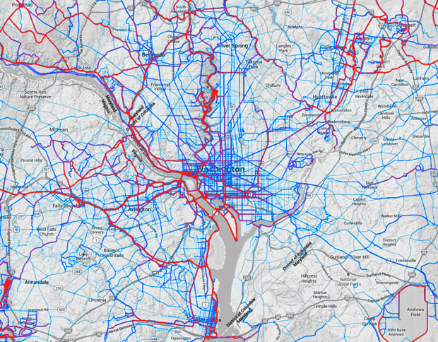
The least-traveled routes appear as light blue lines, moderately used routes are darker blue, and the most popular corridors are represented in thick magenta. On the running map, for instance, it is not surprising that the Mall is almost entirely painted over in magenta. McLean’s Great Falls Park is another popular running spot.
The bike map shows heavy use of the Capital Crescent Trail linking Silver Spring and Georgetown, the Washington and Old Dominion Trail through Northern Virginia, and the Metropolitan Branch Trail between Silver Spring and Union Station. Rock Creek Park and Beach Drive are popular destinations for both cyclists and runners.

Benjamin Freed joined Washingtonian in August 2013 and covers politics, business, and media. He was previously the editor of DCist and has also written for Washington City Paper, the New York Times, the New Republic, Slate, and BuzzFeed. He lives in Adams Morgan.

 - Washingtonian")


 - Washingtonian")


