An article published Wednesday in the journal Nature projects the West Antarctic ice sheet is melting far more quickly than previously anticipated. The study suggests that by the year 2100, the ice sheet’s accelerated melting—one of the most-feared effects of global climate change—could double global sea-level rises to six feet by the end of the century.
A previous climate model produced in 2013 by the Intergovernmental Panel on Climate Change predicted global sea-level increases of about three feet by 2100. But the findings published in Nature bode far worse if the effects of climate change are not mitigated. An increase of six feet would spell certain doom for coastal cities everywhere, especially the East Coast of the United States.
The six-foot increase is a worst-case scenario, but that scenario appears more and more realistic. According to the National Oceanic and Atmospheric Administration, 2015 was the warmest year on record since weather records were first kept; the second-warmest year was 2014. And 2016 has been pretty toasty, so far, with last month registering as the hottest February ever monitored.
“Antarctica has the potential to contribute more than a meter of sea-level rise by 2100 and more than 15 meters by 2500, if emissions continue unabated,” the paper’s authors, Robert M. DeConto of the University of Massachusetts and David Pollard of Pennsylvania State University, write in their abstract. “In this case atmospheric warming will soon become the dominant driver of ice loss, but prolonged ocean warming will delay its recovery for thousands of years.”
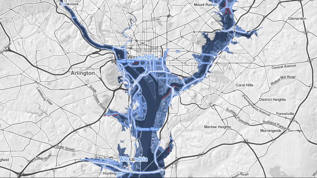
To see what these kind of sea-level increases might do to Washington, there is an online mapping tool from Climate Central, an organization of climate scientists, that allows users to see what would happen to their cities. The Risk Zone Map uses data from the IPCC’s 2013 report and can be set to different increases in sea levels.
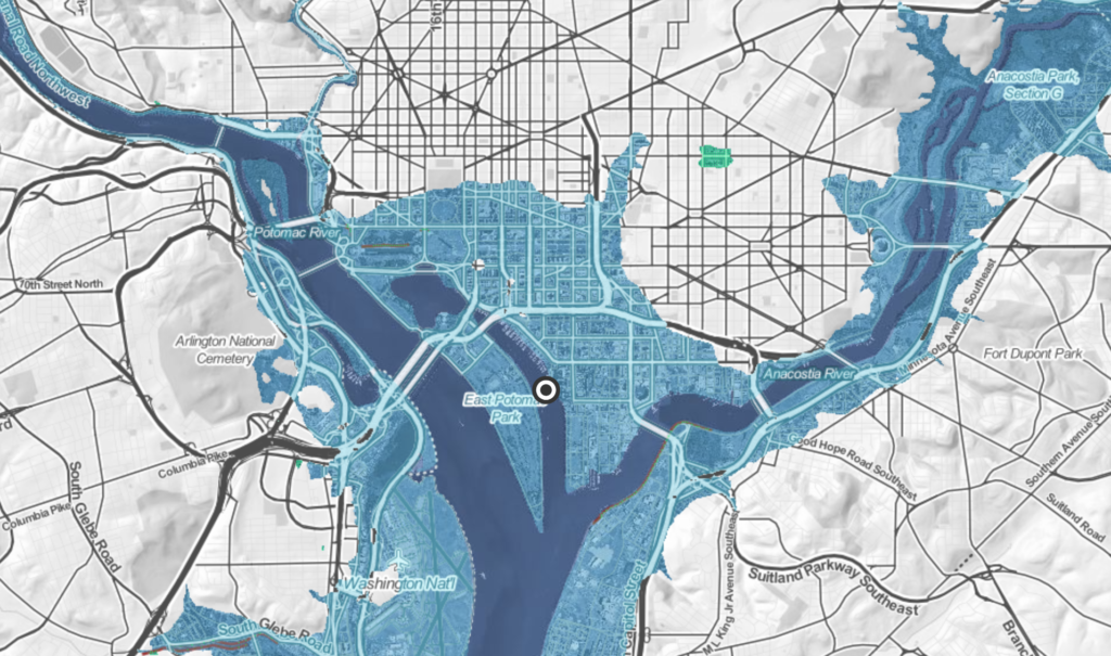
Washington is relatively untouched if sea levels rise three feet, though that scenario would sink much of Gravelly Point, the Tidal Basin, the northern bit of Joint Base Anacostia-Bolling, and the road around East Potomac Park (sorry, cyclists).
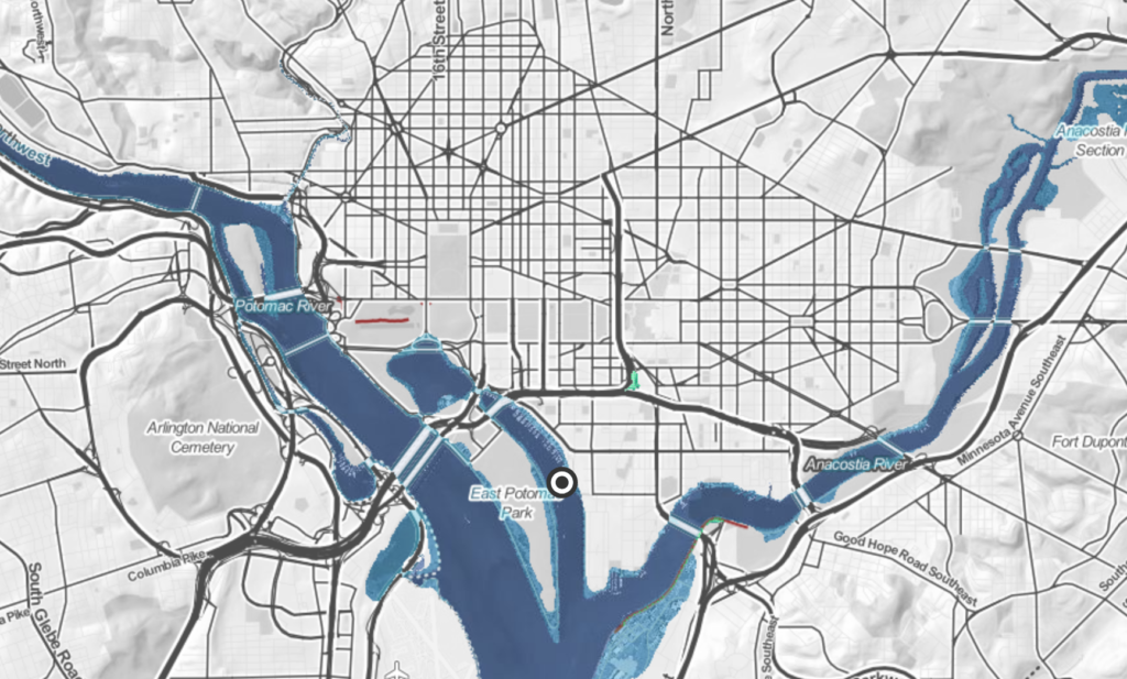
At six feet, Washington is still much better off than other coastal US cities like Boston (underwater), Miami (underwater), New Orleans (underwater), and New York (RIP West Side Highway), but not by much. Rising waters start cutting into the tarmac at Washington Reagan National Airport, much more of Bolling is gone, Anacostia Park is wiped out, and much of the development around Navy Yard is now only accessible by boat.
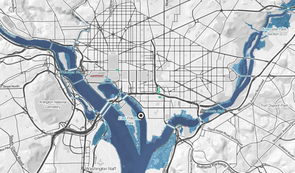
To see what DC will look like in even more catastrophic circumstances, we have to switch from measuring the sea-level rise in feet to measuring in meters. At three meters, more of Navy Yard, Anacostia, and Bolling are gone; East Potomac Park is nearly completely underwater; National has lost much of its runways; and swaths of downtown DC, the National Mall, and Capitol Hill are submerged. Go a bit downriver, and Alexandria’s waterfront has been washed away, too.
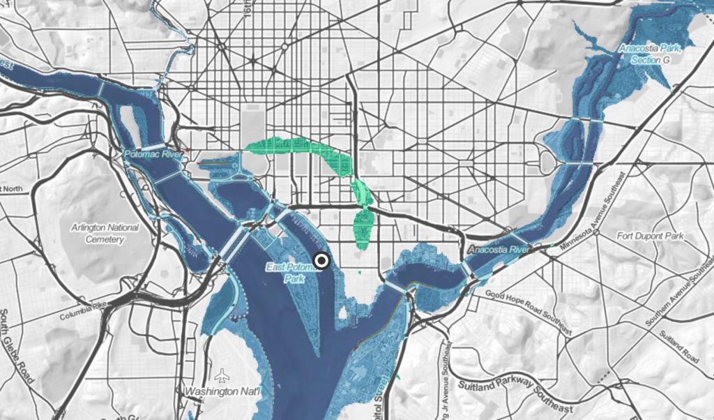
Here’s what a ten-meter rise in sea levels could to to Washington. This is far into the future, but maybe not that far if the current trends of record-setting temperatures don’t change.
