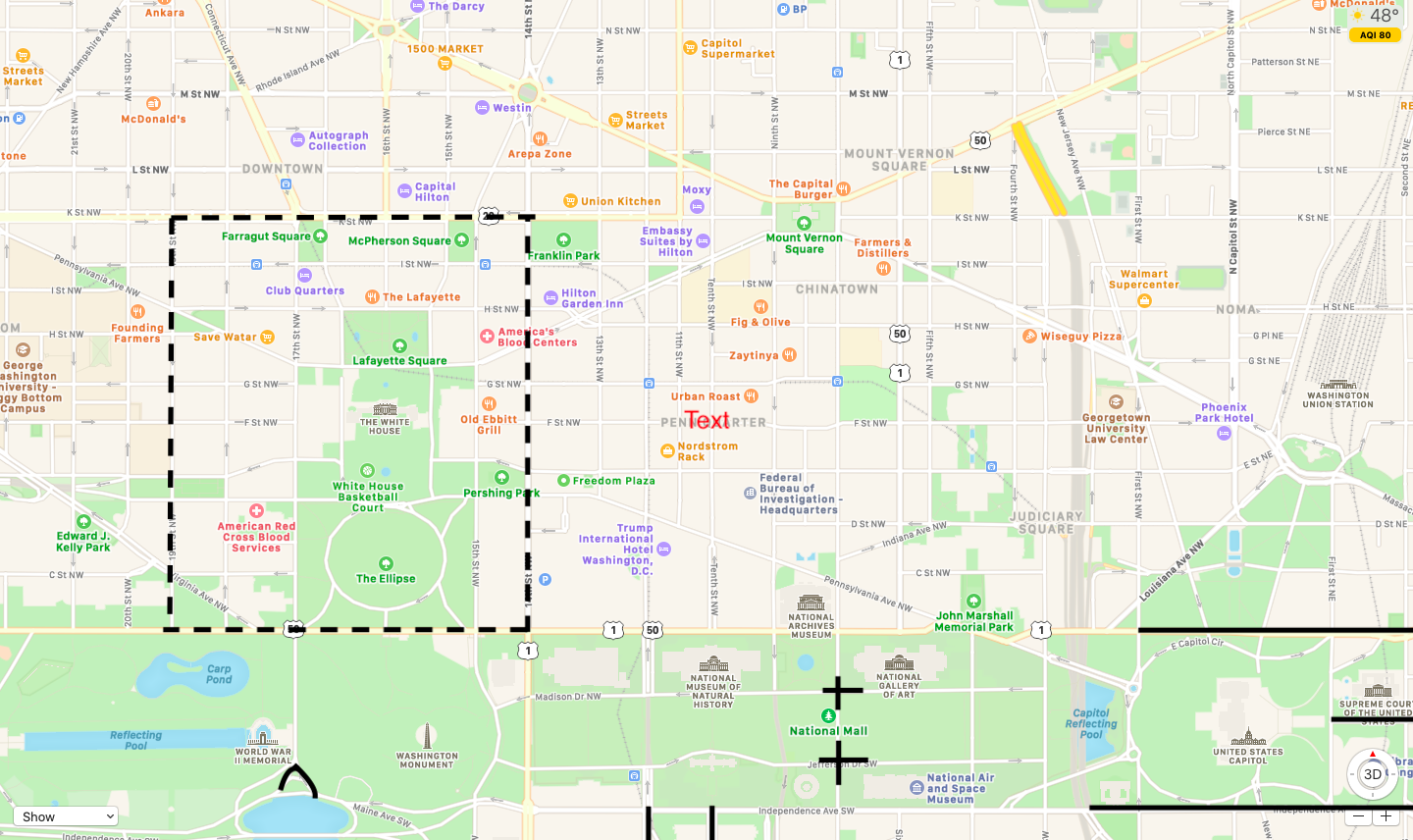
DC’s inauguration street closures went into effect at 8 AM today—some folks are calling the area the “Capitol Green Zone”—and will remain in effect until after the inauguration. Street closures are marked on the map with a solid line and the dotted line around the White House indicates the larger perimeter fence that’s been erected.
Here are the street closures announced by the city:
- Independence Avenue between Washington Avenue, SW, and Second Street SE
- Constitution Avenue between First Street NW and Second Street NE
- East Capitol Street between First and Second streets
- 18th Street at Constitution Avenue NW
- 17th Street at Independence Avenue SW
- 11th Street at Independence Avenue SW
- 12th Street at Independence Avenue SW
- 7th Street at Madison Drive NW
- 7th Street at Jefferson Drive SW
The new White House perimeter is bordered by K Street, 14th Street, 19th Street, and Constitution Avenue, Northwest. All parking garages in that area and in secure areas around the Capitol will be blocked off until after the inauguration, and cars will not be able to be moved.
Street closures are subject to change, and additional security measures are expected closer to the inauguration. A National Parks spokesperson says the Secret Service will be releasing a security plan for the National Mall in the coming days, and that street closures might extend to pedestrians as well as around the inauguration depending on security needs.

