During Wednesday’s unprecedented shutdown, Metro discovered 26 areas along its tracks where power cables connected to the third rail needed immediate replacing. Left unattended, transit officials said, the damaged cables could have sparked fires similar to the one in January 2015 that killed 61-year-old Carol Glover when a stalled Yellow Line train near L’Enfant Plaza filled with smoke.
A similar blaze did actually break out Monday near the McPherson Square station, though it happened early enough in the day that no one was physically harmed. Still, the electrical fire knocked out large chunks of the Blue, Orange, and Silver lines through downtown DC for nearly the entire workday, prompting Metro to make an immediate assessment of a crucial part of its infrastructure.
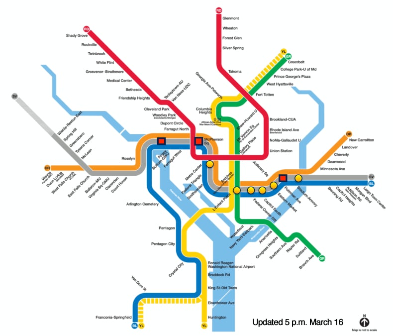
The bulk of the damage was found in the Blue, Orange, and Silver trunk that runs beneath downtown DC, according to a map Metro presented at a press conference yesterday. The most severe damage was found at Foggy Bottom, McPherson Square, and Potomac Avenue.
During the inspections, Metro crews discovered cables damaged by debris, corrosion, and water infiltration. And although Metro General Manager Paul Wiedefeld said that the degraded equipment did not pose an imminent fire threat, the conditions still presented an elevated fire risk hazardous enough to warrant immediate repairs.
You can see just how bad the damage got in this video taken by Metro crews during the inspection process.

