If you drive west to Garrett County, Maryland, and ask people what Potomac is like, they usually say they don’t spend much time “downstate.” They watch the Pittsburgh nightly news and, on Sundays, root for the Steelers.
When I asked people in the tony Washington suburb of Potomac about Oakland, the Garrett County seat, they unfailingly replied, “Where’s that?”
Maryland is a ragtag jumble of mansions and mountain towns—it’s normal not to know much about what goes on 170 miles away. But the people who live along the Youghiogheny River and the ones who take the Red Line into DC each morning have something in common: They are all residents of Maryland’s 6th Congressional District. Which means these strangers-turned-bedfellows share something else: They are the most gerrymandered people in America.
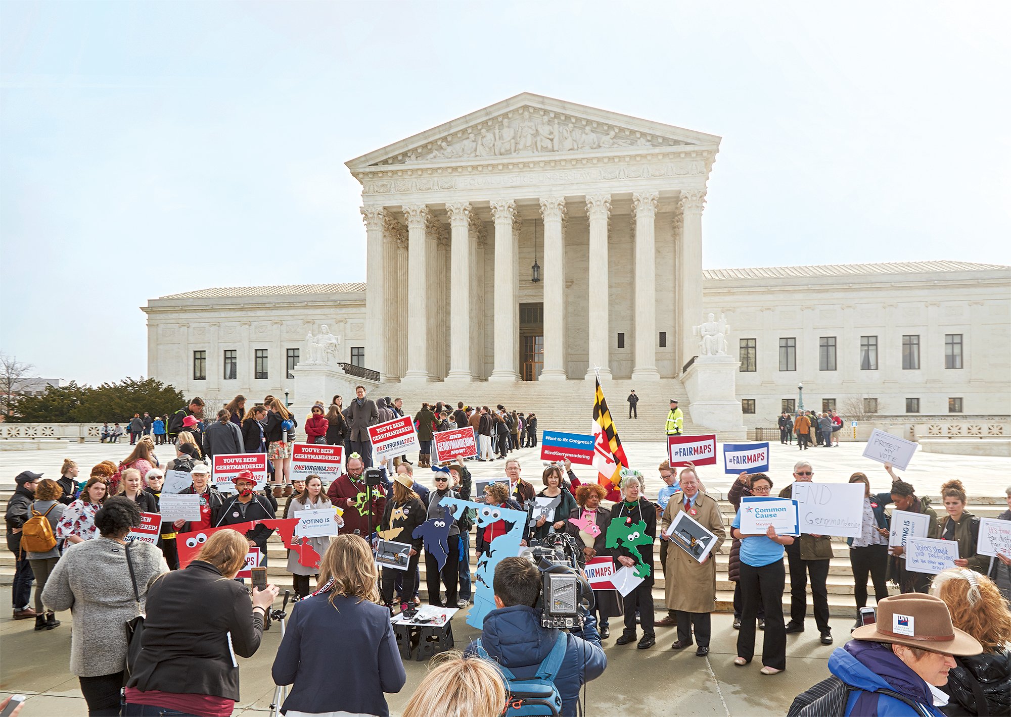
At least they are for now. In March, the Supreme Court heard a groundbreaking challenge to the district’s wild contours, brought by seven Republican voters. These Marylanders argue that the Grand Canyon–size district—in a state whose seven others would barely cover the map of Massachusetts—was redrawn to punish the region’s GOP voters.
Before the court’s term ends next month, the justices may hand down a decision that radically changes American politics. Benisek v. Lamone is one of two cases before them that take on an age-old system allowing members of Congress to handpick their constituents, effectively deciding their contests well before Election Day.
But the battle over Maryland’s 6th is different than other gerrymanders—and not just because Democrats are the culprits. The pols who rigged this district left behind a massive paper trail that lays out exactly how it all happened, an operation so fine-grained that mapmakers parked a district line less than a block from a candidate’s house.
Look behind the doors this case has pried open and it’s easy to see why the court is now asking: Is enough finally enough?
America’s constitution mandates a census every ten years to figure out how many congressional districts each state gets. Which means that every ten years, legislators get a fresh shot at twisting their state’s imaginary lines to their party’s advantage.
If states like Arizona and California—where congressional maps are drawn by bipartisan commissions—represent the democratic ideal, most states fall short, with pols haggling over voting precincts as if they were baseball cards. Maryland, though, is the Wild West. It’s the only state in the Union where the map comes directly from the governor’s office.
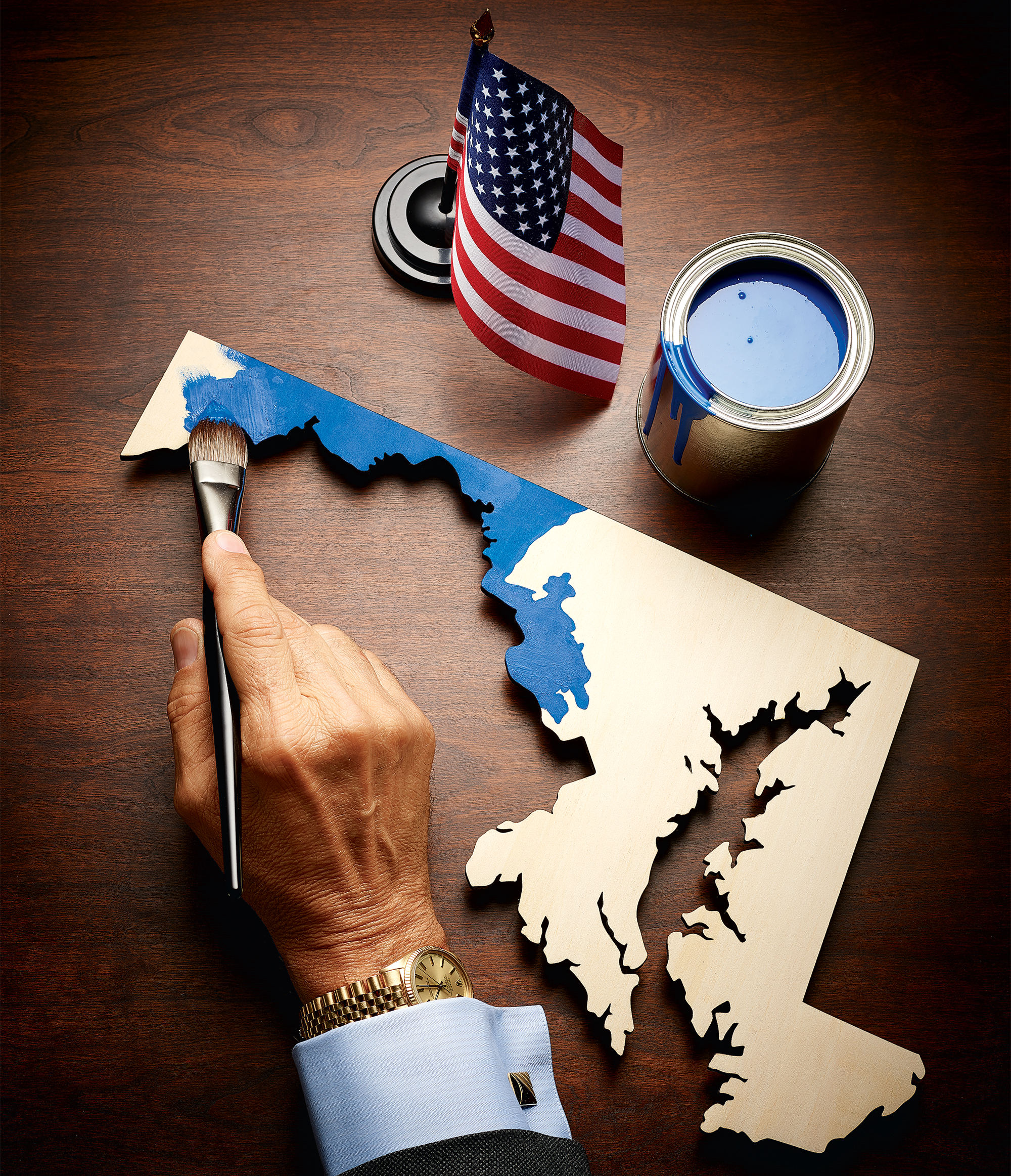
And it’s the governor’s desk where the saga of the 6th District began, back in 2011. The 2010 census data had landed just months after Republicans swept the midterm elections, ensuring that GOP statehouses could create bright-red maps across the country. Maryland was an exception: Democratic governor Martin O’Malley and his overwhelmingly Democratic legislature were in charge. They could paint the map as blue as the Chesapeake—an intention the governor was shameless about. Dems in the congressional delegation already outnumbered Republicans 6–2, but a 7–1 split sounded even better. As O’Malley said in a deposition, “I felt that was not only my responsibility but my duty.”
The battle over Maryland’s 6th is different than other gerrymanders: The pols who rigged this district left behind a massive paper trail.
The rules governing this so-called duty are scant—there’s not much O’Malley couldn’t try besides racial gerrymandering. Courts also prefer contiguity and compactness: All things being equal, a district should look more like a square and less like an octopus. But anything else is fair game. And thanks to big data and operatives who know how to mine it down to the census block, exploiting these gray areas has never been simpler. Boundaries that used to be laboriously plotted with calculators and pencils can be dragged around with a mouse. New districts are carved with the efficiency of a bulldozer but the precision of an X-acto knife. “Drawing these lines is as easy as buying something on Amazon,” says David Daley, a senior fellow at the electoral-reform nonprofit FairVote. Today’s mapping software reads current trends and projects them into the future. You can flip a district in 2011 and be pretty damn sure how it will vote in 2020.
For help, O’Malley turned to the congressional delegation itself. As soon as the 2010 census results came in, he tapped 37-year congressman Steny Hoyer, telling the self-described “serial gerrymanderer” to come up with a map that the rest of his colleagues—the Democratic ones, at least—would support.
Hoyer engaged a boutique Washington consulting shop called NCEC Services. It’s a big player in mapmaking and voter targeting for the party, with clients such as the Democratic Congressional Campaign Committee and the Democratic Senatorial Campaign Committee. But the real reason you hire the firm is for an inconspicuous little Excel column labeled Democratic Performance Index, a calculation of a candidate’s probability of picking up a given precinct to the nearest one-hundredth of a percentage point. How the firm mixes the special sauce is a mystery, but it’s more like the clarification of a fine consommé than opening a can of Campbell’s. The higher the number, the better the chances of keeping your seat.
And for these members of Congress, no number would be high enough.
There are really only two moves when it comes to gerrymandering: cracking and packing. Cracking means dividing the other party’s voters across so many districts that they can’t get a majority in any of them. Packing is the opposite—rounding up the other side’s voters into the same district so their votes are wasted. The more GOP votes the new map could corral into a single district, the better a Democrat’s chances would be everywhere else in the state.
When Eric Hawkins, one of Hoyer’s consultants, got to work, he initially hovered his mouse over the Republicans’ stronghold in the 1st District, spanning the Eastern Shore. To make it blue, he would need to crack GOP-leaning precincts and replace them with pieces of Democratic cities like Annapolis and maybe Baltimore.
Hawkins would need the buy-in of John Sarbanes, who represented both in Congress. So on March 16, at a meeting in the consultants’ office, Hawkins presented two maps to the congressman’s camp. Both were “7–1 maps,” a tag staffers used for versions that would put seven Democrats in the House after the next election. (Hawkins also drew an 8–0 map that made his clients recoil: They wanted more Dems in Congress, but not so badly that they were willing to risk their own margins of victory.)
What followed was an all-out scrum among Democratic incumbents—each focused on self-preservation and the whole thing recorded for posterity in e-mails and other documents.
“Drawing these lines is as easy as buying something on Amazon.”
First came Sarbanes, who didn’t like the options. The congressman was being asked to take on more than 150,000 Anne Arundel County constituents to help a former Democratic representative named Frank Kratovil win back his Eastern Shore seat. After the March meeting, Sarbanes’s chief of staff followed up with Hawkins to discuss how the congressman could “drop these new areas and still get Kratovil and Hoyer what they need.” Sarbanes was being asked to shoulder a lot. “No one else can claim a similar sacrifice,” the aide wrote.
The consultants tweaked the map, eventually getting Sarbanes’s Democratic Performance Index score back up. But a bigger obstacle loomed in Baltimore, where the scheme would involve parceling out a majority-minority district. For that, the mapmakers needed the support of the state’s Black Caucus. The caucus’s response was to put forward a redistricting plan of its own. Hoyer’s senior adviser worried that the plan would “spook” at least one member of Congress. “Um, yeah,” Sarbanes’s chief of staff agreed. “It’s a recipe for a 5–3, not 7–1.”
Donna Edwards, the then congresswoman from Prince George’s County who was fresh off a blockbuster win in 2010, sided with the caucus. “Donna is telling us we have to do the 6th district,” Hoyer’s adviser wrote to NCEC Services in June.
Nobody was eager to rankle a member as popular as Edwards, so they gave up on helping their old friend Kratovil. Instead, the mapmakers scrolled left, to Garrett County.
As far as the general public knew, the redistricting process hadn’t even kicked off yet. Typically, Maryland’s governor sets up an advisory committee that holds hearings around the state and ostensibly advises the governor—as one official called it, “the first key visible step.” But five months into the consultants’ work, O’Malley hadn’t yet convened the committee.
When he eventually did, he chose Jeanne Hitchcock, his Secretary of Appointments, who had no experience with congressional redistricting, to chair the process. O’Malley also was advised that his committee should include one Republican. Hitchcock turned to James King, a former Maryland House delegate who runs a restaurant-management company. King doubted he’d have any sway but says he figured “it was better to have a voice at the table.”
The group met for the first time in July 2011. Among other items on the agenda, the committee was coached on media strategy. “Above all else,” meeting notes read, “downplay politics.” Yet if the group was asked about a redistricting proposal that the GOP had submitted to O’Malley, there were talking points the committee members could deploy: “Maryland Republicans are putting the cart before the horse. It’s great they’ve produced a map before we’ve held our first public hearing—but this process is about gathering input from the citizens of Maryland before we produce a map.”
No one mentioned that the Democrats were doing the exact same thing.
Hitchcock’s committee squeezed a dozen perfunctory hearings into the summer. But despite this public show, the bulk of its work was confined to redistricting the map for the state legislature, King says. In keeping with decades-long Maryland tradition, the congressional map “primarily was drawn” not by the public-facing committee, according to the testimony of another member, but “by the congressional people [themselves].”
On October 3, O’Malley was ready to give the state’s Democratic lawmakers an advance look at his map. But first Hitchcock delivered the PowerPoint to an audience that included several staffers from the congressional delegation. She presented the map district by district, starting with the GOP-held 1st, now elongated to hoover up rural parts of Carroll, Baltimore, and Harford counties that previously had belonged to congressman Roscoe Bartlett, the delegation’s other Republican. In other words, the Republicans got packed.
Meanwhile, over in Bartlett’s territory—the 6th—slides revealed that Republicans were about to get cracked. Hard.
Population growth in Maryland necessitated that 10,189 voters be removed from the 6th to comply with the constitutional doctrine that says every district should have roughly the same number of people. The map accomplished this by moving out more than 360,000 residents—almost half the district’s population—and moving in 350,000 others. Frederick County was split into two districts for the first time since before the Civil War. Exactly 66,417 registered Republicans were shifted to areas where they’d never have enough votes to win. The Democratic Performance Index in the 6th had been 37 percent. Now it would be 53 percent.
Better yet, Hitchcock told the group that the proposal “does not draw any incumbent member of Congress out of his/her district.”
But the problem with a map that’s been gerrymandered to carve out a seventh Democratic district while preserving the Performance Index scores of six overcautious incumbents is that it’s hard to make it look like much more than that: a gerrymandered map.
The whiplash of driving the district line at pace here reminded me of Mr. Toad’s Wild Ride.
At least one staffer in the room could see that the consultants’ work was so good that it would be difficult to spin. As he watched Hitchcock try to justify the wildly rewired districts, Sarbanes’s chief of staff unlocked his BlackBerry and fired off a message to Hoyer’s senior adviser: “This is painful to watch.”
Don’t worry, Hoyer’s aide responded, “Jeanne is good on the political message.”
“I hope so,” Sarbanes’s chief replied.
The Democrats’ official line: They had redrawn the 6th to reflect travel patterns along I-270.
Sarbanes’s chief sounded less than convinced: “I’m not sure I buy the themes they are selling.”
But lawmakers weren’t focused on the nuances when they got their look at the map later that evening. As one House delegate told a reporter, “It reminded me of a weatherwoman standing in front of a map saying, ‘Here comes a cold front,’ and in this case the cold front is going to be hitting Roscoe Bartlett pretty hard.”
The governor’s map cruised through the statehouse. When Election Day came in November 2012, the delegation got what it wanted—a 7–1 state. No real hiccups.
Well, with one exception. Not content simply to paint the 6th blue, the Democrats also had a preordained winner in mind: state senator Robert Garagiola. But another Democrat was interested. John Delaney, a Potomac financier who’d never held office, heard that the district was being reconfigured to include Montgomery County—he just couldn’t be sure which side of the line his house landed on. “I inquired naively about it” and never heard back, Delaney says. When the final map came out, “my neighborhood was notched out.” (A source with firsthand knowledge believes that the slight was deliberate.)

Delaney ran anyway and won, beating Bartlett by 21 percent, an almost inconceivable margin for a sitting representative. It was the single largest redistricting swing in the country in 2012, according to the Cook Political Report. The Republican, Bartlett, had gone from having a 99.7-percent chance of winning to having a 94-percent chance of losing.
“My first degree was in theology,” says Bartlett, who has since retired. “I learned to love the sinner, hate the sin. I like Nancy Pelosi. If you ask Steny Hoyer, he’ll say we’re friends. It wasn’t personal.”
The gnarly story of how the 6th got made, it turns out, is as twisty as the roads of its perimeter. Curious what the backroom tradeoffs had to do with the voters the Congress members were manipulating, I got in the car with my cell phone for a map (my first mistake) and a leather jacket (which would eventually be my second).
My goal was to drive the district without ever crossing its helter-skelter perimeter. I chose as my starting point a wealthy peninsula only four miles from DC, where River Road meets the Beltway. I circled Bethesda Country Club, which is in, and swerved around Congressional Country Club, which is out. I slowly drove the 0.2 mile that separates Delaney’s mansion (in the 8th) from mansions a lot like Delaney’s (in the 6th).
But almost as soon as I left Potomac and got on the highway, I failed. The state has argued that the new 6th was drawn to reflect I-270. What I realized from behind the wheel is that the first section of the highway is actually in the 8th. Taking exit 1 steered me straight into the NIH campus and the densely populated heart of Bethesda. Trying to maneuver back to the safety of the 6th pitted me against the Google Map lady and her calm insistence: “In a quarter mile, make a U-turn.” No. “In a quarter mile, make a U-turn.” But I can’t!
Eventually, I fought my way west, where the district darts from the highway to pick up woodsy-sounding towns in which houses are spread so thin that you can’t even hear the splash from your neighbor’s pool. As I nooked-and-crannied my way back to where the district kisses I-270, there was even less to see. Along the veins and capillaries feeding the highway traffic sit brick boxes with black-glass windows and logos you might find floating in your alphabet soup: GSK, APL, ABC.
This is where the district diverges. To the southeast, it swings around Rockville, picking up suburbs like Aspen Hill, then urgently receding to leave other ones behind. The whiplash of driving the district line at pace here reminded me of Mr. Toad’s Wild Ride. I doubled back to the northwest, where the 6th reaches out for Frederick city, leaving most of Frederick County behind. These are the voters that the 6th was built for: a pick-and-mix of left-leaning enclaves to overpower Republicans in the west.
“We’ll never have such a record again. The people who do the gerrymandering are not stupid.”
Frederick is something of a continental divide for the district. Western Maryland even has its own weather. The first time I visited, it was sunny and in the 50s in Potomac. When I got out of my car in Oakland, 20 minutes past Garrett County’s Deep Creek Lake resorts, it was the middle of the day and snowing. People drove faster than I thought was safe, which is exactly how you drive when you get more snow than Boulder. My leather jacket felt as thin as prosciutto against the cold.
It’s hard to explain how different this patch of Appalachia is from Montgomery County without resorting to clichés, documenting the double-wides, tree farms, and roadside flotsam that have become a kind of shorthand for the region. To be honest, I visited the ubiquitous churches and crossed the rusting truss bridges—those things are all here. There’s an annual fiddle championship in Friendsville, and being crowned Autumn Glory Queen will still land you in the Parsons Advocate—a local paper out of West Virginia.
Most people I met in Garrett County actually do feel more kinship with West Virginia than with their home state. The Facebook page for Free Western Maryland, a secessionist group, has 9,600 followers. A cashier named Shawn who drives into Oakland from Terra Alta, West Virginia, for work calls the tourists who come up to nearby Wisp Mountain “tourons.” Jeff, a shop owner down the road, tells me the folks who come antiquing from Baltimore are called “Baltimorons.” “We’d rather be in West Virginia,” he says—the taxes are lower. Corey, a Cumberland native, puts it more starkly: “People in government don’t think anyplace west of Hagerstown matters anyway.”
One afternoon, I drove to Wolfsville in Frederick County to visit Sharon Strine, a plaintiff in the Supreme Court case. Besides working on her family’s farm, Strine, 54, has developed a small political-consulting business after volunteering on a couple of campaigns. She says she has always been civic-minded, registering to vote on her 18th birthday. She believes that the redistricting process punished her for exercising her First Amendment rights, including how she expressed herself through voting.
“Every time, we lose a seat,” Strine says, remembering back 20 years to when the congressional delegation was a 4–4 split. “I knew we were on the chopping block.”
She’s not the only one fed up. When Michael Kimberly of the DC law firm Mayer Brown agreed to represent Strine and the other voters pro bono, he put out a call for more plaintiffs. “I had to turn people away,” he says of the response.
The state, of course, has maintained its I-270 defense. But one federal judge has already called it “flimsy.” And what was left of its credibility after the Democrats’ victory lap in 2011 and O’Malley’s ownership of the gerrymander has since crumbled under oath. “I get a little confused,” Hitchcock told lawyers about her public committee’s rationale for rejiggering the 6th. “Either people in Washington were working in Washington and living in Western Maryland or vice versa, yeah. I can’t remember.” Committee member James King isn’t sure traffic patterns ever came up: “I don’t have any recollection of 270.”
For many at the Supreme Court hearing in March, the nakedly partisan gerrymandering was never in question. “However much you think is too much,” Justice Elena Kagan told the state’s attorney, “this case is too much.” The question, for those justices, is whether to do anything about it.
In an ironic twist, the strength of the evidence that Strine and her fellow plaintiffs have brought to the court may be a problem. The e-mails and depositions showing that officials and their staffers conspired to secure incumbent protection and raw political advantage—not representation and not competitive races—stack as high as Garrett County’s Backbone Mountain. But if the plaintiffs prevail, it’s easy to imagine what will happen next. Files containing draft maps will be overwritten. E-mails will become phone calls. “We’ll never have such a record again,” Justice Stephen Breyer warned the courtroom. “I mean, the people who do the gerrymandering are not stupid.”
Turnout in the 6th’s Republican primary fell in the midterm following redistricting. Even Strine, who says she has voted religiously over the years, is finally having a “rough time” getting excited about candidates she knows will lose.
I thought about that as I traveled home, this time taking the route Google Maps determined was most efficient. I bounced between states and districts 11 times, ignoring what voters in the 6th District, and in every other gerrymandered district in America, know to be true: The invisible lines we draw to divide us can have big consequences.
Prop Styling by Megumi Emoto at Anderson Hopkins.
This article appeared in the June 2018 issue of Washingtonian.
