UPDATE: This post was updated at 3:25 PM to reflect announced closings due to the weather.
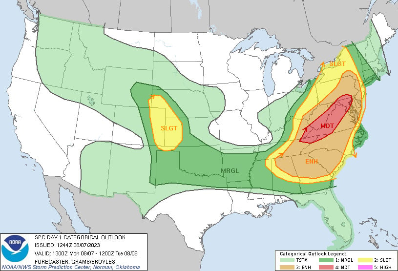
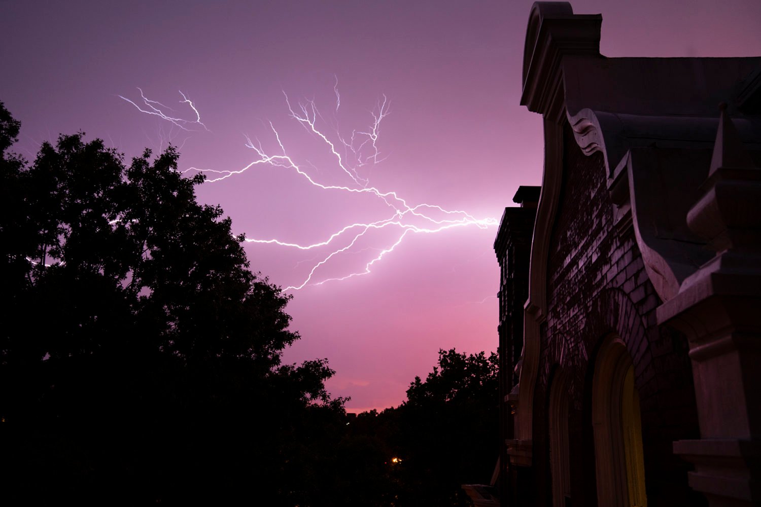
Meteorologists are projecting that a potentially intense thunderstorm will tear through the mid-Atlantic region this afternoon and evening. Hot temperatures, an expected cold front, and high winds are combining to create a big-impact storm that’s expected to include severe winds, hail, flooding, and tornadoes. The National Weather Service has issued a “moderate risk” alert for the region stretching from Baltimore to Johnson City, Tennessee. Don’t let the word “moderate” fool you—that can mean a menacing storm, and this area has not had a storm warning at that level in ten years.
“There’s certain ingredients that can help develop storms, and we’ve got all of them today,” says Anna Stuck, a meteorologist at NWS. The storm is projected to hit the Washington area between 5 and 8 PM, so try to stay inside when the storm is at its most severe and stay updated on local weather alerts.
The expected storm is shutting down offices and agencies around DC. Federal offices in the District closed at 3 PM, and all employees were asked to leave. DC public libraries, the Smithsonian (including the National Zoo) and Arlington National Cemetery also shut down at 3. Nationals Park said in a 12:56 PM statement that it would “continue to assess” weather conditions throughout the day; the venue is slated to host singer-songwriter P!NK for a concert tonight.
In the meantime, we asked Stuck to answer some questions about the storm:
When you say we are at “moderate risk,” what does that mean?
The storm prediction center rates the risks on five levels. Moderate risk is a level four out of five and that means that they’re expecting long-lived, widespread, and intense storms; several severe storms could be significant. Significant is defined as gusts at least 75 miles per hour, hail at least two inches, and tornados of at least EF2.
What do you mean when you say tornadoes of EF2? Because when I hear tornadoes, I think of the Wizard of Oz.
That is localized, very high wind speeds rotating. You know, it is exactly what you picture. It’s just rotating wind that could be wide or it could be pretty skinny. There is a threat for a few tornadoes today. Tornadoes are classified [on] five levels, EF0 up to EF5. EF2 is a strong tornado with wind speeds of 111 to 165 miles per hour.
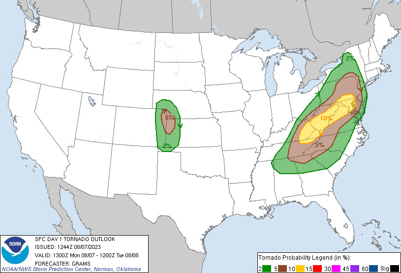
Are there areas where tornadoes are more likely to touch down?
It’s basically anywhere within the storm. The moderate risk excludes portions of western and eastern Maryland. So anywhere where that moderate risk is, we have that higher risk of tornadoes.
Is a storm this severe—moderate risk—something you see very often?
The last time the DC area or the Baltimore metro area was [in moderate risk] was in 2013. There was one in 2008, a moderate risk, kind of over the area, and there were numerous wind reports and tornado reports across the area.
If the storm is as bad as projected, what kind of damage could we see across the region?
For the wind damage, downed trees and power lines. With the tornadoes, it would basically be the same, downed trees and power lines widespread, or it could be isolated in an area. But with wind, the biggest threat is downed trees, they could block roadways, fall onto structures, things like that.
In relation to the bad storm that we had about a week ago, how is this storm comparable?
Last week we had somewhat widespread wind damage caused by microbursts and we had winds gusts measuring up to 84 miles per hour from storms. We didn’t have any tornadoes last week. We aren’t necessarily expecting that level of high winds this week, but we are expecting wind gusts up to 60 to 70 miles per hour, which will still do extensive damage.
What kind of precautions should I take? Should I bring my lawn chairs inside?
If you have any lawn furniture that can come inside, bring it in. And have multiple ways to receive warnings. That’s probably the biggest thing. Make sure your phone’s charged because if thunderstorms have strong winds, we’ll send out a wireless emergency alert that will come over your phone like an Amber Alert does. If they have NOAA weather radios, make sure those are on and working. And then, if you have a way to watch TV and you still have power, tune into your local TV station, and the local meteorologists will be communicating our watches and warnings.
For people commuting, should people try to head back from work early?
If they are able to. I don’t wanna tell people to leave work [if] it could negatively impact them. I would say it’s important to look at what the weather is doing when they would be driving home from work, and if it seems hazardous, maybe stay at work later.
You said the storm is expected to go from about 2 to 11 PM across the region while the Washington metro area will be at its most severe from 5 to 8 PM. Is it supposed to clear after that?
It should clear up tomorrow. Later in the week, there is a risk for showers and thunderstorms, but we’re not expecting anything as severe as today.
This interview has been edited for length and clarity.

