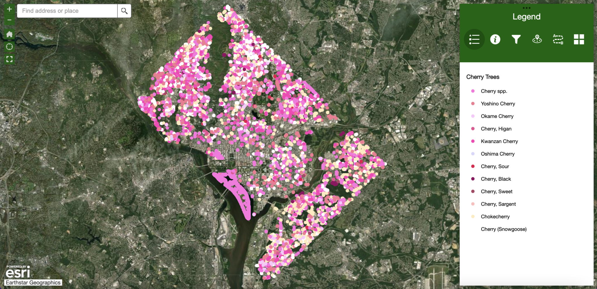
You don’t have to brave the crowds at the Tidal Basin to enjoy the glories of cherry blossom season, which kicks off next week (peak bloom runs from March 22 to March 25). The delicate pink, violet, and white blooms bedazzle across the entire District—and DC-based nonprofit Casey Trees has a detailed map of where to find them.
Using the map’s legend, you can check out a neighborhood’s inventory of trees. The map is color-coded by variety of cherry blossom, and there are several: Yoshino, Okame, Oshima, and Sour Cherry, just to name a few. Michaila Musman, the Geographic Information Systems manager at Casey Trees, suggests tracking down the Sargent Cherry, which develops pinkish white blossoms and is called the “crème de la crème” of flowering cherries by the Arbor Day Foundation. “They can also support bird species around the city, which is a wonderful bonus,” says Musman.
The map is an annual tradition at Casey Trees, which dedicates itself to cultivating and protecting DC’s tree canopy. To build the inventory, staff and volunteers venture on foot into the city’s parks to identify and measure each and every tree they come across. “We can do better advocacy and tree protection if we know what our tree canopy across the city looks like,” said Musman.
Other data points for the map come from DDOT’s Urban Forestry Division and from cherry trees that Casey has planted. Most of the trees on the map are located on public land, so if your or your neighbor’s yard is the proud home of a cherry tree, it may not appear (think of it as your own secret garden).
And if you miss the cherries this time around, the organization also maintains a separate map of all the flowering trees in the city. Musman recommends checking out the Eastern Redbud. “They are native to this area and they have these deep fuchsia blossoms,” she says. “They look like they came right out of a Dr. Seuss book.”

