When battling rush-hour traffic and fighting crowds on the metro, it can be easy to forget that Washington was not always the bustling metropolis it is today. A new gallery of historic photographs on the District Department of Transportation’s Web site captures the city in the 1940s, 1950s, and 1960s. Just imagine how cheap real estate was back then…

This photo, taken on February 13, 1963, shows East Capitol Street running west over the Anacostia River and towards RFK Stadium (upper right-hand corner).
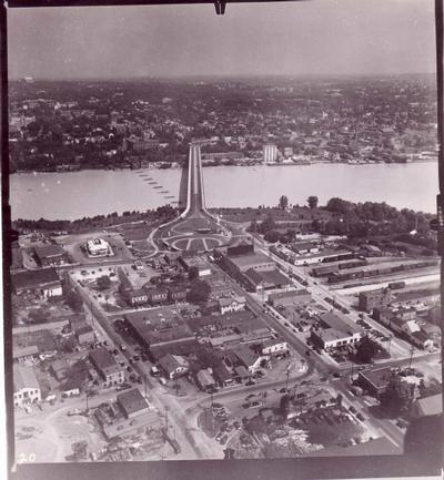
This is a circa 1945 shot looking from Rosslyn over Key Bridge into Georgetown.

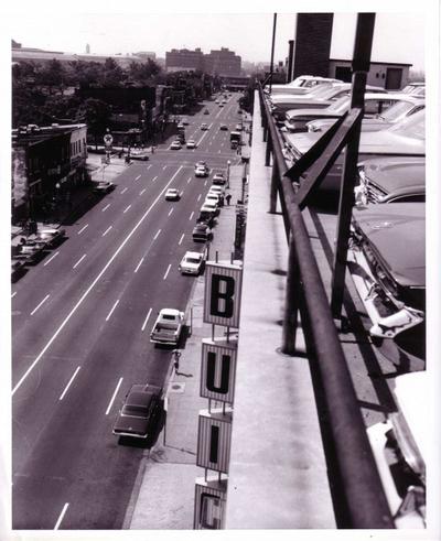
In this picture of Connecticut Avenue below Dupont Circle, there's a separate tunnel for streetcars. It was taken in 1958.
Taken on September 1, 1961, this shot is looking west at H and 7th streets, NE. Later that decade, the area was devastated by the rioting following the assassination of Martin Luther King, Jr., and it's only been in the last year that serious redevelopment is beginning to take place with the rise of the Atlas District nearby at 13th and H. If you're looking for a real investment these days that might pay off down the road, you could do worse than this area.
What will Washington look like 40 years from now?